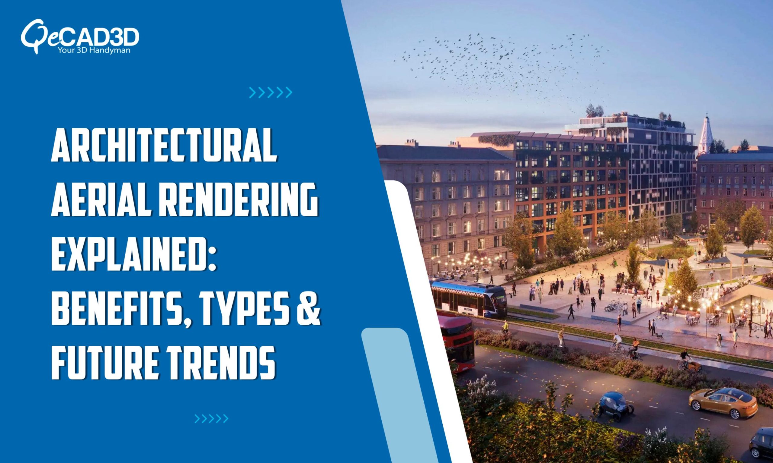
Architectural Aerial Rendering Explained: Benefits, Types & Future Trends
Introduction
Architectural visualization has transformed the way building projects are conceptualized, designed and promoted. Among the many techniques available, aerial rendering stands out for its ability to provide a bird’s-eye view of the architectural designs within their environmental context. Whether for the urban planning, the real estate development or for the infrastructural projects, the architectural aerial renderings offers invaluable insights and an immersive perspective.
This blog explores everything about the architectural aerial rendering, its benefits, applications and how it enhances the design communication.
What is Architectural Aerial Rendering?
Architectural aerial rendering is a 3D visualization technique used to create high-quality, detailed images of the buildings and landscapes from an elevated perspective. These exterior renderings simulates how a project will appear from above, incorporating the surrounding landscapes, infrastructures along with the urban elements for a realistic portrayal.
By using the aerial renderings, the architects, developers as well as the investors can gain a comprehensive understanding of the spatial relationships and the project’s impact on its surroundings. As part of the 3D Visualization Services, aerial renderings play a crucial role in showcasing the architectural designs with the exceptional clarity and realism.
Key Benefits of Aerial Rendering
- Enhanced Visualization of Large-Scale Projects
Aerial renderings provides a macro perspective hence making it easier to analyse the large-scale projects like residential communities, commercial complexes as well as the urban developments.
- Realistic Contextual Representation
Integrating the surrounding environments—roads, green spaces along with the neighbouring buildings ensures an accurate and real-world depiction of the project.
- Improved Design Decision-Making
The stakeholders can assess the various design alternatives as well as their impact on the environment thereby leading to a more informed and strategic decision-making.
- Effective Marketing & Client Presentations
The developers and realtors uses the aerial renderings to create visually compelling presentations that attracts the investors, buyers and city planners.
- Supports Urban Planning & Infrastructure Development
The city planners uses the aerial renderings to assess the traffic flow, zoning and environmental impact thereby contributing towards the sustainable development.
Distinct Types of Aerial Renderings
The architectural aerial renderings can be categorized into several types based on their purpose and level of detail:
- Photorealistic Aerial Renderings
These are highly detailed, lifelike renderings that can accurately represent the textures, lightings as well as the surroundings thereby making them ideal for the marketings and presentations.
- Conceptual Aerial Renderings
They focus more on illustrating the design concepts along with the master planning using the simplified models to highlight the layouts and functionalities.
- Bird’s-Eye View Renderings
They do offer a top-down perspective, showcasing the entire project’s site and its surroundings. They are commonly used for the large-scale urban planning projects.
- Helicopter View Renderings
They simulate an angled aerial perspective hence providing a more dynamic visualization of the project in relation to the nearby landmarks and the terrains.
- Drone-Integrated Aerial Renderings
They do combine the real drone photography with the 3D models to create the hyper-realistic representations thereby enhancing the accuracy and realism.
- Interactive Aerial Renderings
These renderings allows the users to navigate and explore the designs dynamically and often incorporate the VR or AR technology to create an immersive experiences. They are widely used in the presentations, urban planning as well as the real estate marketing.
Applications of Architectural Aerial Rendering
- Real Estate Marketing: Helps potential buyers and investors to visualize the properties within their larger communities.
- Master Planning & Urban Development: Provides a holistic view of the city expansions, public spaces and large-scale infrastructures.
- Resort & Hospitality Design: Showcases how luxury hotels, resorts and entertainment hubs fit within the landscapes.
- Commercial & Industrial Projects: Depicts the large-scale developments like the shopping malls, warehouses and the factories within their environments.
- Municipal & Transportation Planning: Visualizes roads, bridges, airports as well as the railway stations for better planning and execution.
How Aerial Renderings Are Created?
The process of creating the architectural aerial renderings involves multiple stages:
- Data Collection: Acquiring the site information, topography and the existing infrastructural details.
- 3D Modeling: Constructing the primary architectural elements using the software like SketchUp, Revit or 3ds Max.
- Environmental Integration: Adding a real-world context to it including the roads, landscapes along with the neighbouring structures.
- Texturing & Lighting: Enhancing the realism with the superior materials, refined textures and immersive lighting effects.
- Rendering & Post-Production: Using the advanced rendering engines like V-Ray, Lumion or Unreal Engine to generate the photorealistic images.
Best Tools for Creating Aerial Renderings
- Lumion – The real-time rendering tool with an intuitive interface which is ideal for the architects and designers.
- V-Ray – Used for the high-end photorealistic renderings, this tool also integrates with other software like 3ds Max, SketchUp and Rhino.
- Twinmotion – Powered by the Unreal Engine, this tool enables immersive and interactive aerial renderings.
- Enscape – The real-time rendering tool within the Revit, SketchUp and Rhino used for streamlining the workflows.
- Blender – A free and open-source tool featuring the powerful Cycles and Eevee rendering engines.
- GIS Software (ArcGIS, QGIS) – This tool enhances the aerial renderings with the precise topographical data integration.
Future Trends in Aerial Rendering
With technological advancements, the aerial renderings is evolving in the following ways:
- Drone-Based Aerial Mapping: It integrates the real drone photography with the 3D renderings for an unparalleled accuracy.
- AI-Powered Rendering Automation: It is faster and more efficient rendering processes through the artificial intelligence.
- Virtual & Augmented Reality Integration: It is interactive aerial walkthroughs using the VR and AR technology.
- Sustainability & Green Urban Design: It focuses more on the eco-friendly urban planning as well as the green architecture.
Conclusion
Architectural aerial rendering has revolutionized how the projects are curated and marketed. By offering a bird’s-eye view of developments within their real-world context, these renderings empower the architects, developers as well as the city planners to make more informed decisions. Whether you’re in the real estate, urban planning or the infrastructural development, the aerial renderings can elevate your project’s visual storytelling and marketability.
For expert 3D rendering and visualization services, QeCAD3D specializes in delivering high-quality aerial renderings tailored to your needs. Our Exterior Rendering Services ensures that your projects are presented with the stunning visual appeal thereby making a lasting impression on the clients as well as the investors. Get in touch with us to bring your architectural concept to life!